Civil Infrastructure

Structural Elements
Capture existing conditions with precise precision by integrating HDS Scanning into your standard workflow

Topography
Gather exact forms and features of land surfaces by implementing UAV’s equipped with the proper sensors to expedite site analysis and decrease the margin of errors that occur with more traditional methods

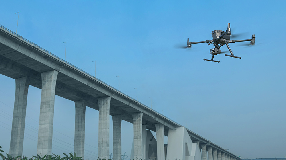
INFRASTRUCTURE INSPECTION: FACADE & BRIDGE
Gather data faster and inspect large infrastructure by deploying UAV’s and extracting the inspection data from photogrammetry and video of existing conditions
Software
Utilize the standard design software and optimize your workflows through NOAR training and support on the latest versions of the Autodesk flagship software and increase awareness of the latest software to enter the design space


CORRIDOR ROAD DESIGN
Comprehensive design and analysis to ensure efficiency, safety and sustainability on critical highway corridors utilizing the latest technological workflow incorporating UAV, HDS Scanning and cutting-edge design software

UTILITY INFRASTRUCTURE
Execute provisions of utility infrastructure and design and planning by a comprehensive workflow incorporating the existing conditions with functionality and decrease risk and costs of projects

SURVEYING
Rely on drones to survey civil infrastructure projects and construction sites, limiting human entry and possible injury by instead hovering in the air above your site
CIVIL INFRASTRUCTURE
Gather existing data faster and accurately, provide more informative information at a lower cost with drones, HDS scanning and Autodesk software to simplify data acquisition for Civil Infrastructure engineering.
Projects that deal with design, construction, and maintenance of the physical and naturally built environment, are the backbone infrastructure and support economy and quality of life.
Infrastructure design evolves quickly and requires an overhaul and often costly upgrades to transform to the most resilient, innovative technological solutions available. Leading edge reality capture technology can increase efficiencies and decrease errors in design and creation.

Advantage
Engineering firms can partner with NOAR Technologies for their ongoing drone, scanner, and software licensing needs.
Partnering with NOAR Technologies optimizes Civil Infrastructure firms to adapt to technical changes efficiently and effectively to decrease down time and expedite implementation without sacrificing adequate training to ensure success. All with a single point of contact.
With over 30 years of expert knowledge of Civil Infrastructure engineering we are proud to partner with some of the best firms in the country and specialize in the adoption and execution of seamless integrations to bring collaboration between software designs and real-world existing conditions. We encourage our customers to consider NOAR Technologies as an extension of their workforce, and we look forward to technical support calls on hardware, software and project challenges.
Technology is always evolving. NOAR Technologies will focus on navigating new solutions and guiding your firm in the right direction.


Our Partners
We have strong partnership with the biggest brands. That’s why we can offer the best solutions
.png)
.png)
.png)

.png)