DJI Zenmuse L3
High Accuracy, Survey-Grade LiDAR For Aerial Mapping, Surveying, Modeling & Corridor Inspection
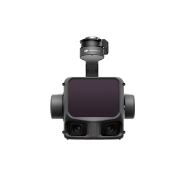
DJI Zenmuse L3
The DJI Zenmuse L3 is a next-generation LiDAR payload engineered for survey-grade accuracy, long-range detection, and high-density point cloud capture—fully optimized for the Matrice 300/350 RTK platforms. If your teams perform large-area topographic surveys, corridor mapping, urban modeling, or powerline inspections, the L3 delivers the precision, reliability, and workflow efficiency needed for demanding aerial data collection.
Where older airborne LiDAR systems required heavy processing and complex setups, the L3 offers a streamlined, enterprise-ready workflow backed by integrated RGB imaging, advanced IMU performance, and robust RTK positioning.
At NOAR Technologies, we help organizations adopt the L3 with confidence—from system configuration and mission planning to LiDAR processing, analysis, and operational training.
What Is the DJI Zenmuse L3?
A Survey-Grade LiDAR Payload Built for Real-World Field Conditions
The L3 combines a high-performance LiDAR sensor, precision IMU, and integrated 4K RGB camera into a compact aerial mapping system capable of generating clean, dense, colorized point clouds across a wide range of environments.
Key performance advantages:
- 250m detection range at 10% reflectivity
- 240,000 pts/sec for high-density terrain and structure models
- Up to 5 returns for strong canopy and vegetation penetration
- RTK-grade accuracy via integrated IMU + GNSS
- 4K RGB camera for automatic point cloud colorization
Whether you’re flying large construction sites, scanning utilities, or mapping engineered surfaces, the L3 maintains accuracy across changing terrain, canopy density, and lighting conditions.
Who It’s Built For
The L3 is designed for teams requiring accurate, efficient, and repeatable geospatial data capture:
- Surveying & mapping firms
- Civil engineering teams
- Construction progress & QA/QC groups
- Utility, powerline & corridor inspection programs
- Rail, roadway & pipeline mapping crews
- Environmental & forestry specialists
- Organizations expanding from photogrammetry into LiDAR workflows
If you need survey-grade precision, vegetation penetration, or detailed 3D reconstruction—not just imagery—the L3 is a strong operational fit.
Top Benefits
1. Survey-Grade LiDAR Accuracy
Ideal for:
- Topographic surveys
- Engineering design surfaces
- Contours & digital terrain models
- Cut/fill and elevation analysis
High-density point capture supports consistent, engineering-ready deliverables.
2. High Productivity in Complex Environments
Long-range detection + multi-return LiDAR enable mapping through:
- Vegetation
- Steep terrain
- Narrow corridors
- Urban and vertical structures
This reduces revisits and shortens field time.
3. Integrated RGB for Colorized Point Clouds
The onboard 4K RGB camera automatically colorizes LiDAR data for improved:
- Visualization
- Client deliverables
- Construction/engineering interpretation
4. Seamless Integration with Matrice 300/350 RTK
Plug-and-play compatibility with:
- DJI Pilot 2 mission planning
- RTK-enabled flight paths
- Real-time point cloud previews
- Enterprise data security & workflow controls
5. Reliable Data Capture in Challenging Conditions
The Matrice platform provides:
- High wind tolerance
- Excellent hovering stability
- Industry-leading obstacle awareness
This results in cleaner, more complete datasets with fewer flight adjustments.
L3 vs Older Drone-Based LiDAR: When the L3 Is the Right Choice
Choose the Zenmuse L3 if you need:
- Longer range + higher point density
- Better canopy penetration
- Integrated RGB colorization
- Improved IMU accuracy
- Faster, automated flight workflows
- A simpler, more stable mapping workflow than heavy or older LiDAR systems
If your projects require fast turnaround, consistent surfaces, or reliable corridor mapping, the L3 is the more capable and efficient option.
Real-World Use Cases
Topographic & Engineering Surveys
High-resolution LiDAR + RTK delivers:
- Accurate terrain modeling
- Detailed surfaces for design/engineering
- Dense data for earthwork & site planning
Construction Progress & QC
Use dense point clouds + RGB imaging for:
- 3D reconstruction & progress tracking
- Volume measurement
- As-built comparison
- Cut/fill validation
Utility & Corridor Mapping
Long-range LiDAR and precise hovering support:
- Powerline and conductor mapping
- Vegetation clearance measurement
- Rail, pipeline & roadway modeling
- Structural and clearance assessment
Forestry & Environmental Applications
Multi-return LiDAR provides:
- Ground modeling through canopy
- Biomass and vegetation density analysis
- Terrain assessments in remote areas
Field Operations Made Easier
The L3 is designed for practical, high-efficiency flight workflows:
- Real-time point cloud preview for on-site validation
- Automated RTK-enabled missions for consistent coverage
- DJI Pilot 2 optimization for corridor, grid, and structure flights
- Secure data capture with enterprise-level controls
- Reduced rework thanks to stable hover and long-range detection
Less time in the field. More accuracy per flight.
Compatible Matrice Platforms
- Matrice 350 RTK
Maximum flight time, high wind resistance, and robust build for large-area and corridor missions. - Matrice 300 RTK
A widely adopted enterprise platform used across surveying, AEC, and utilities.
Not sure which airframe fits your workflow? Our specialists can help you choose the right combination of payload, aircraft, and accessories for your mission types.
Key Features at a Glance
- Detection Range: Up to 250m (10% reflectivity)
- Point Rate: 240,000 pts/sec
- Returns: Up to 5 returns
- IMU: High-precision IMU with RTK
- Camera: Integrated 4K RGB
- Compatible Airframes: M350 RTK, M300 RTK
(Full technical spec sheet available upon request.)
NOAR Value
When you partner with NOAR Technologies, you gain:
- On-site & virtual LiDAR training
- Mission planning strategy for repeatable accuracy
- Workflow optimization for survey, construction, and utility projects
- Data processing support (DJI Terra & third-party software)
- Program setup, SOP development & FAA guidance
- Hardware bundles, batteries & accessories
Our mission is simple: help you confidently capture, process, and deliver high-accuracy LiDAR data across all your mapping and inspection workflows.
Is the L3 Right for You?
If you need a drone-based LiDAR system that combines survey-grade accuracy, long-range performance, high-density point capture, and RGB colorization—without the complexity of older systems—the Zenmuse L3 is an excellent choice.
Request a Quote or schedule a demo


Our Partners
We have strong partnership with the biggest brands. That’s why we can offer the best solutions
.png)
.png)
.png)

.png)

