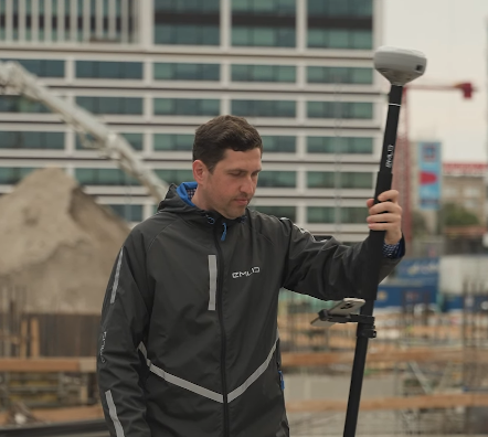
Reach RS4 Pro GNSS Receiver
High-Precision, Camera-Enhanced GNSS for Surveying, Mapping & Construction
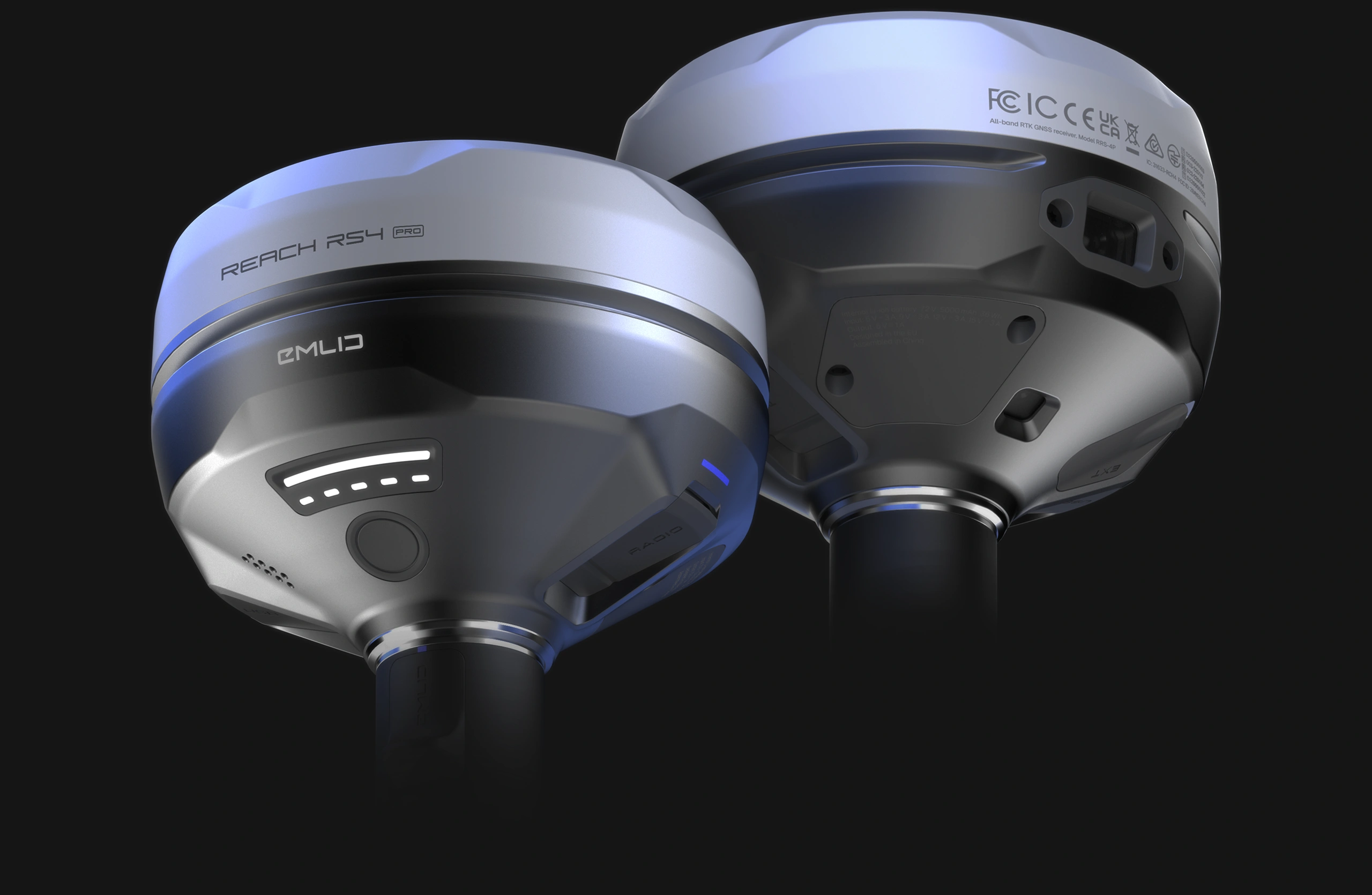
Reach RS4 Pro GNSS Receiver
High-Precision, Camera-Enhanced GNSS for Surveying, Mapping & Construction
The Emlid Reach RS4 Pro combines all-band RTK GNSS performance with dual cameras and advanced tilt compensation—giving field teams faster, safer, and more accurate ways to capture position data. Built for modern surveying and construction workflows, the RS4 Pro enables AR stakeout, remote point capture, and measurement-from-image capabilities that reduce time in the field and improve ROI on every project.
GNSS performance depends heavily on workflow fit, accuracy requirements, and site conditions. Buyers evaluate how well a receiver will perform in dense urban corridors, near tree cover, and on active construction sites. The RS4 Pro's all-band tracking, fast RTK fixes, and camera-supported measurements make it a strong choice for organizations needing reliable positioning in challenging environments.
At NOAR Technologies, we help organizations integrate new GNSS hardware into real-world workflows. From selecting the right configuration to training your crews and connecting your data to the rest of your ecosystem, we ensure the RS4 Pro delivers measurable value from day one.
Why Choose the Reach RS4 Pro?
All-Band RTK GNSS with Centimeter Accuracy
The RS4 Pro supports multi-frequency signals across all major constellations—GPS, GLONASS, Galileo, BeiDou, and QZSS—providing fast, resilient RTK fixes even in GNSS-limited environments. This addresses top considerations around accuracy, reliability under canopy or near structures, and overall RTK performance.
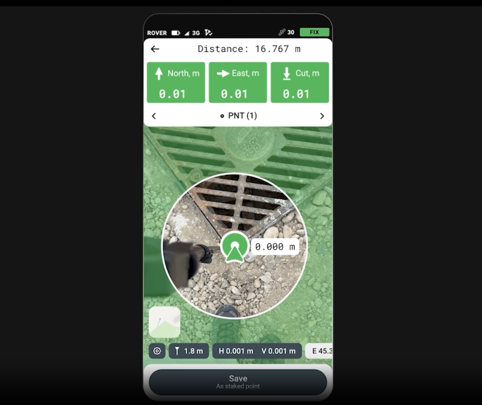
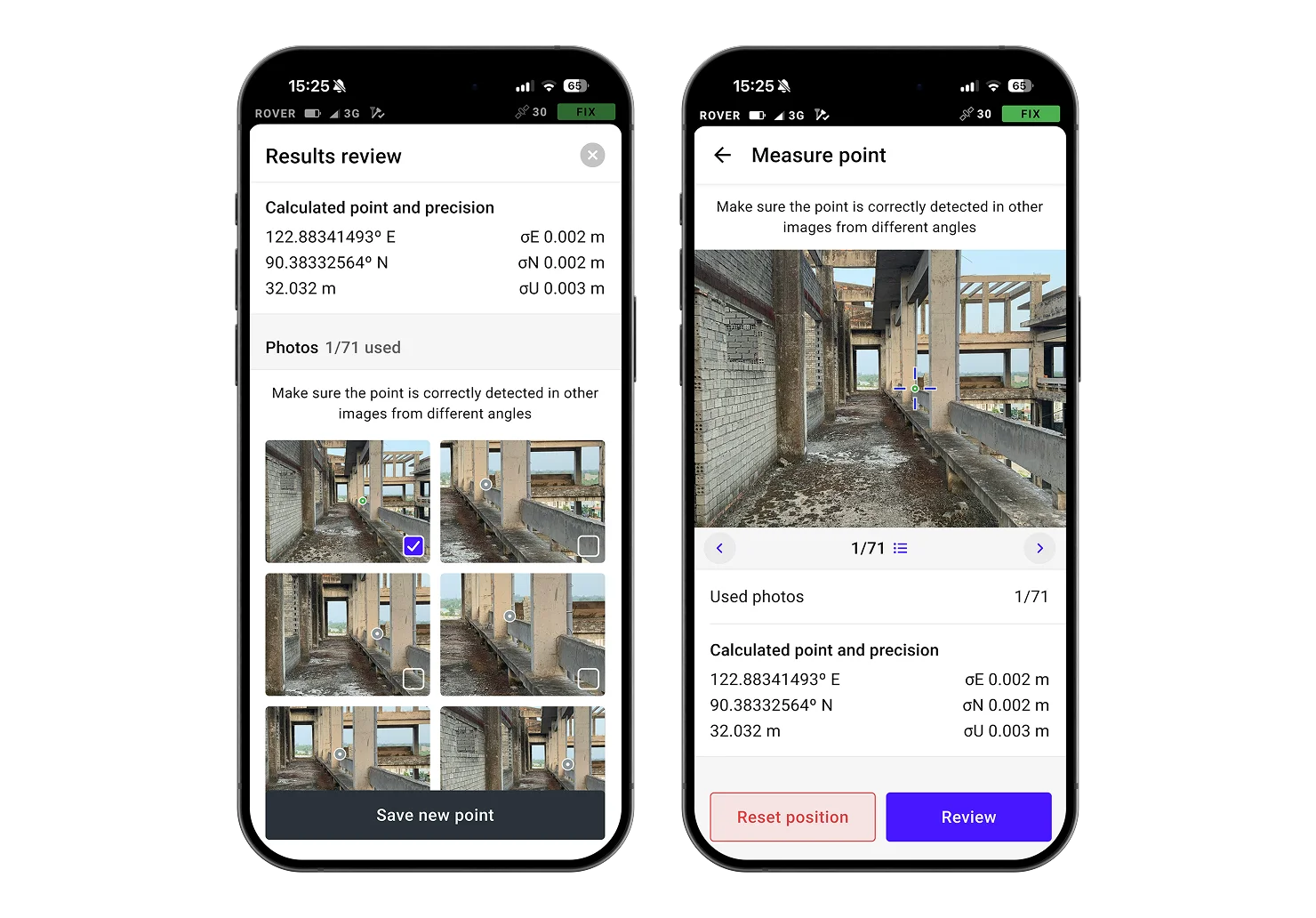
Dual Cameras for Visual Stakeout & Remote Point Capture
The built-in front and bottom-facing cameras enable new GNSS + vision workflows:
- AR stakeout using camera overlays
- Photo-based measurements from multiple angles
- Safe remote collection of points near traffic, utilities, or hazardous areas
- High-accuracy photogrammetric correction when GNSS signal is limited
These camera-driven capabilities increase field safety, improve measurement confidence, and enable efficient work in obstruction-heavy sites.
Tilt Compensation for Faster Fieldwork
Survey and stakeout without leveling the pole. Emlid's calibration-free tilt engine lets crews record accurate points—even on slopes, uneven surfaces, tight spaces, or rebar-heavy job sites. This directly aligns with real-world needs for speed, usability, and reduced operator errors in actual job conditions.
Flexible Connectivity: Base or Rover
Use RS4 Pro as a rover, base, or part of a hybrid network:
- LoRa
- UHF
- NTRIP
- LTE/Internet-based corrections
This flexibility helps you match the RS4 Pro to your preferred correction workflow—CORS networks, site bases, multiple rover fleets, or remote projects where radio performance matters.
Built for the Field
- IP68 & MIL-STD rugged housing
- All-day internal battery
- -20°C to +65°C operating range
- Hot-swap accessories and mounting options
Ruggedness, battery life, and durability matter. The RS4 Pro is engineered for crews who work in real job-site conditions—not ideal lab scenarios.
What the RS4 Pro Enables for Your Team
Faster Layout & Stakeout Accuracy
Tilt compensation + AR-guided camera workflows speed up stakeout for:
- Foundations & footings
- Roadwork & utilities
- Structural layout
- Concrete & interior layout
Teams focused on speed of data capture and field efficiency will see significant gains in daily productivity.
Safer Data Capture Around Hazards
Capture points without standing directly on them—ideal for:
- Busy roadways
- Deep excavations
- Pipes, conduits, and utility corridors
- Rooftops, edges, or confined areas
This speaks directly to priorities around crew safety and risk reduction.
Reliable Positioning in Tough GNSS Conditions
Multi-band, multi-constellation tracking improves reliability near:
- Buildings and facades
- Tree cover
- Machinery and equipment
- Complex construction sites
This addresses one of the most important considerations: how well the receiver performs when GNSS conditions are not ideal.
Technical Highlights
GNSS Performance
- Multi-band, all-constellation RTK
- Centimeter-level accuracy
- Fast fix acquisition
- High update rate for dynamic workflows
Camera System
- Dual cameras (front + downward)
- AR stakeout
- Measurement from images
- Enhanced quality control in the field
Tilt Compensation
- No calibration required
- Works on slopes, trenches, and uneven ground
- Maintains RTK-level precision
Connectivity
- LoRa / UHF radios
- Wi-Fi, Bluetooth, LTE
- NTRIP compatibility
- Base and rover modes
Rugged Design
- IP68 / MIL-STD certified
- Up to 20+ hours of battery life
- Outdoor-ready display & controls
- Resistant to dust, shock, water, and vibration
Ideal Applications
Surveying & Mapping
- Boundary & topo surveys
- GIS data collection
- Control point establishment
Construction
- Building layout
- QA/QC field checks
- As-built documentation
- Machine control support workflows
Utilities & Infrastructure
- Utility mapping
- Roadway layout
- Pipe & conduit verification
- Subsurface workflows when paired with NTRIP
Request Pricing or Schedule a Demo
Discover how the Emlid Reach RS4 Pro can improve accuracy, speed, and safety for your field teams.
→ Request a Quote and Talk with a GNSS Specialist
Contact NOAR Technologies | 248-906-2375 | info@NOARtech.com


Our Partners
We have strong partnership with the biggest brands. That’s why we can offer the best solutions
.png)
.png)
.png)

.png)

