Leica RTC700 3D Laser Scanner
The Leica RTC700 is the flagship of the RTC series, combining maximum range, exceptional accuracy, and ultra-fast data capture for the most demanding reality-capture challenges. It scans up to two million points per second to a class-leading 270 meters, and adds a dedicated Area Scan mode that resolves detail down to 0.8 mm at 10 meters, the finest in the lineup.


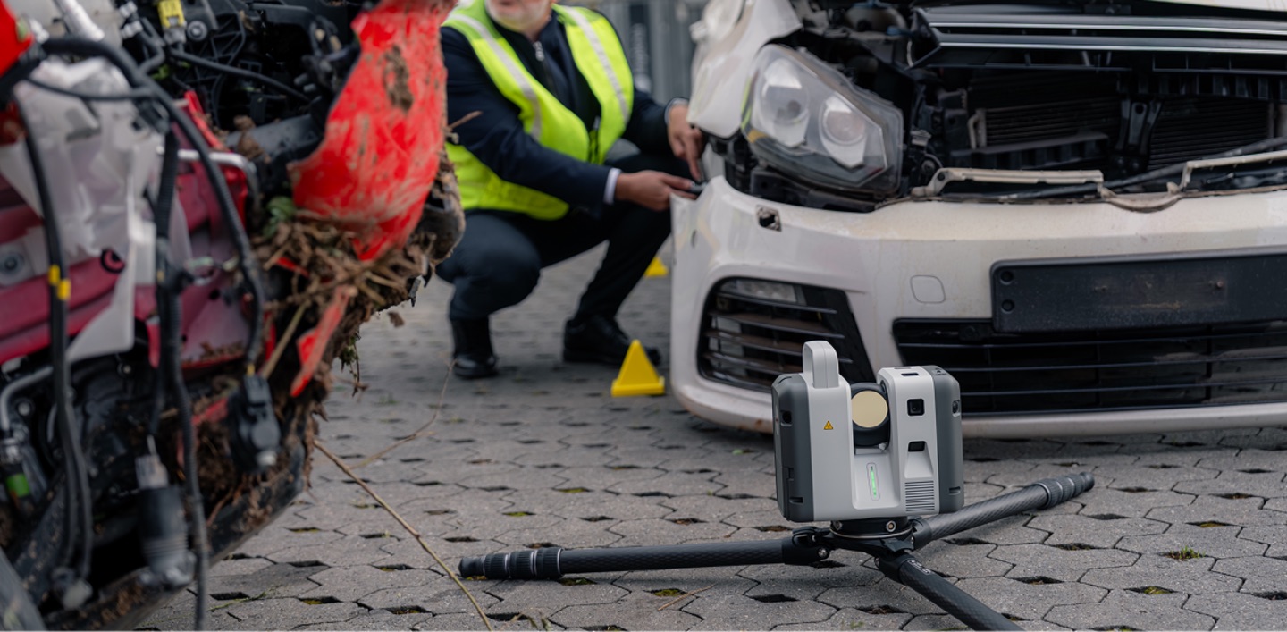
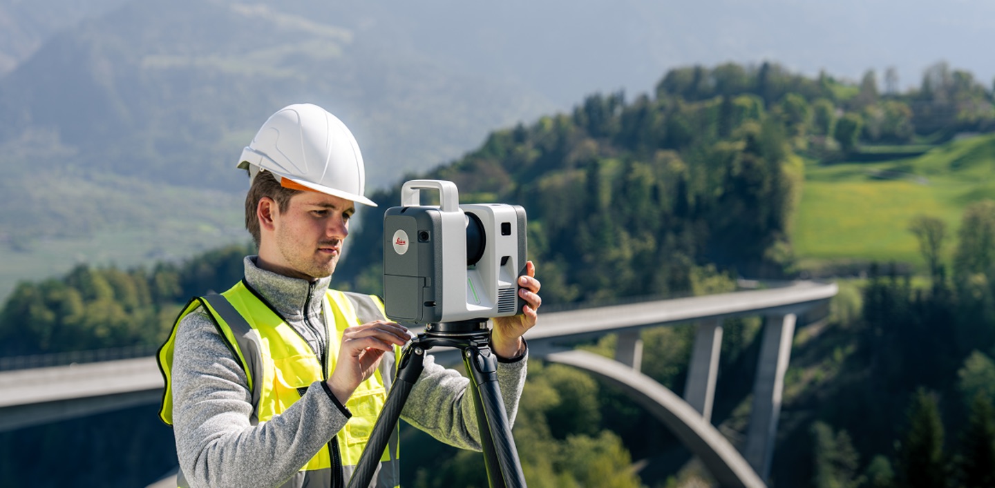
Engineered for industrial facilities, large-scale infrastructure, and complex surveying environments, the RTC700 lets professionals capture high-density 3D data with confidence in the toughest conditions. Advanced connectivity and real-time collaboration let multiple teams, scanners, and office experts operate inside one continuous project environment, reducing downtime, minimising rework, and supporting large, coordinated workflows.
Industry-Leading 270 m Range
The RTC700 reaches a maximum range of 270 meters, capturing to 3.5% albedo at 85 m, 8% at 130 m, and 32% at the full 270 m. That reach lets a single setup cover expansive plants, structures, and infrastructure corridors that would require multiple positions with a shorter-range scanner, fewer moves, fewer registrations, faster completion.
Highest Detail with Dedicated Area Scan
Beyond the standard 1.6, 3, 6, 12, and 25 mm resolution steps, the RTC700 offers an Area Scan mode that captures fine detail down to 0.8 mm at 10 meters, exclusive to the RTC700 in the series. For tight tolerances on industrial components, intricate as-builts, and high-value assets, it delivers the density demanding projects require, while still capturing up to 2,000,000 points per second.
A Full On-Board Surveying Suite
Through Leica Cyclone FIELD 360, the RTC700 supports complete surveying workflows: setup over a known point, known backsight, resection, traverse, target measurements to 75 meters, targets from a full-dome scan, and Area Scan. This turns the scanner into a true survey instrument, letting crews tie reality-capture data directly into project control without a separate total station.
Confidence at Maximum Precision
The RTC700 holds the series' 1.5 mm 3D point accuracy at 10 meters, 10″ angular accuracy, and 1.2 mm + 10 ppm range accuracy, all backed by automatic self-calibration during normal operation. Leica's high-dynamic time-of-flight engine with Waveform Digitising captures clean data across challenging surfaces and long distances alike.
Built for Coordinated, Multi-Scanner Operations
Livelink connectivity in Cyclone FIELD 360 and Hexagon GeoCloud synchronises field crews, multiple scanners, and office teams in real time. As data is captured, project information becomes visible across connected environments, so large teams can coordinate activity and make decisions faster. Finalise and deliver in Cyclone REGISTER 360 PLUS with full reporting on errors, overlap, and tolerances.
Engineered for the Harshest Environments
With a 72 MP / 432 MPx HDR imaging system, IP55 rating upright or inverted, a −20 °C to +50 °C operating range, and up to four hours of runtime on swappable GEB461 batteries, the RTC700 is built to perform where the work is hardest, from active industrial plants to sprawling infrastructure sites.
Quick Facts
• Up to 2,000,000 points per second
• Industry-leading range up to 270 m
• Area Scan detail down to 0.8 mm at 10 m (exclusive to RTC700)
• Full-dome scan + HDR image in ~1 min 40 s
• Complete on-board surveying suite (traverse, resection, known backsight & more)
• 72 MP / 432 MPx HDR imaging, VIS auto-registration, Livelink collaboration
• Laser Class 1 (eye-safe), IP55 rated
• Ideal for industrial plants, large-scale infrastructure, and complex surveying
Frequently Asked Questions
What is the Leica RTC700?
The Leica RTC700 is the flagship terrestrial 3D laser scanner in Leica's RTC series. It captures up to two million points per second to a maximum range of 270 meters, offers a dedicated Area Scan mode down to 0.8 mm at 10 meters, and includes a full on-board surveying suite, making it the highest-performing scanner in the lineup.
What is the range of the Leica RTC700?
The RTC700 reaches 270 meters, the longest in the RTC series, capturing to 3.5% albedo at 85 m, 8% at 130 m, and 32% at 270 m, with a minimum range of 0.5 meters.
What makes the RTC700 different from the RTC300 and RTC500?
All three share the same imaging and connected workflow platform. The RTC700 stands apart with the longest range (270 m vs. 130 m and 85 m), an exclusive Area Scan mode resolving to 0.8 mm at 10 m, a finer 1.6 mm resolution step, and a complete on-board surveying suite including traverse and known backsight.
Does the RTC700 replace a total station?
The RTC700 supports survey workflows such as setup over a known point, known backsight, resection, traverse, and target measurements to 75 meters directly through Cyclone FIELD 360, letting many teams tie scan data into project control without a separate instrument. Whether it fully replaces a total station depends on your project's requirements. NOAR's experts can advise.
What is Area Scan on the RTC700?
Area Scan is a high-density capture mode, exclusive to the RTC700 in the series, that resolves detail down to 0.8 mm at 10 meters, ideal for tight-tolerance industrial components and intricate as-built documentation.
Is there a launch offer on the RTC700?
Yes. NOAR Technologies is offering a limited-edition model to the first 150 RTC700 purchases. Contact NOAR for sales, a demo, roadshow details, or more information.
Leica RTC700 Technical Specifications
Performance highlights
Series specifications
Accuracy figures are stated at a 68% confidence level per JCGM 100:2008, at 89% albedo (range noise for single-shot measurements). Specifications are sourced from the Leica RTC Series data sheet and are subject to change without notice.
Want To Know More?
Download the RTC Comparison Guide
Deploy the Flagship Leica RTC700 — Buy, Rent, or Demo at NOAR Technologies
The RTC700 is built for the most demanding reality-capture work, and NOAR Technologies makes it easy to put into service with confidence. As the leading Leica HDS distributor in North America, we back every unit with software, certified training, and full implementation support for large, coordinated, multi-scanner operations. Ask about the limited-edition model reserved for the first 150 RTC700 purchases, or reserve a rental to experience flagship performance on your own site first.


Our Partners
We have strong partnership with the biggest brands. That’s why we can offer the best solutions
.png)
.png)
.png)

.png)


Contact us
Accurate laser scanning is essential for successful projects. The Leica BLK360 makes laser scanning easier, faster, and more reliable than other scanners on the market. It gives you the best combination of equipment, versatility, ease-of-use, and software so that you can take scans with ease and focus on your other project responsibilities. Plus, it puts powerful tools in the hands of scanning and surveying teams that need minimal training to get the scans that your teams need.
Speed for More Productivity
The Leica BLK360 is faster than most laser scanners on the market. It can complete a 360-degree scan on standard resolution in under 3 minutes. At that speed, surveying teams in difficult or dangerous areas can finish the job and get back to safety faster than ever. Even in higher resolution scans, the Leica BLK360 can out-perform nearly any other scanner on the market in terms of speed.
Compact and Lightweight Design
The Leica BLK360 is small enough to hold in one hand even though it can scan an area 60m away. It is light enough to be mounted on a drone, making it highly versatile and mobile. Whether it is mounted on a stand or on a drone, you can get highly-detailed scans of just about any structure or area.
Multiple Sensor Types for Versatile Scanning
Companies often need to complete different types of scans, and having fewer devices that can fill multiple roles is a strong cost-saving measure. Using the Leica BLK360 gives you access to visual, thermal, and laser scanners to complete the majority of scans that you’ll need in a construction project.
Quick Facts
- 2.2lbs
- 6.5” tall and 4” wide
- Scans in multiple resolution settings
- Mounts on a tripod or drone
Training and Support
Deploying the Leica BLK360 into your operations can lead to major improvements, but many companies are skeptical about acquiring new technology. NOAR Technologies backs the Leica BLK360 with software, support, training, and a rental program so that you can make a smooth transition. Try the Leica BLK360 before you make a full commitment, along with our support and assistance.